"Climbing the highest mountain in Japan." That phrase carries weight. Mt. Fuji rises to 3,776 m — the country's tallest peak — and it presents difficulties you simply won't find on other Japanese mountains. The common assumption that "anyone can climb Fuji in summer" has a body count attached: every year, hikers in light clothing pushing through overnight "bullet climbs" end up dealing with altitude sickness and hypothermia. This guide covers route selection, altitude prevention, and what summit sunrise is actually like for first-time climbers.
Mt. Fuji is a 'special' mountain — what makes it different
Fuji has several characteristics that set it apart from other mountains in Japan.
- 3,776 m elevation: the only peak over 3,700 m in Japan — altitude-sickness risk is high.
- Stand-alone stratovolcano: no adjacent peaks, so there is no ridge-walking or alpine traverse to enjoy.
- Long stretches above the tree line: almost no shade and no place to shelter from rain.
- Short season: the trails are officially open only for roughly two months — early July to early September.
- Enormous traffic: in-season crowds dwarf those on any other Japanese mountain.
In short, the right framing is that Fuji is unlike any other mountain in Japan. Approaching it with a low-elevation day-hike mindset leaves you unprepared for its specific risks: altitude sickness, hypothermia, and rockfall.
Choosing among the four routes
Fuji has four main trails to the summit, and the differences between them are significant. Pick the one that fits your experience and goal.
① Yoshida route (Yamanashi side)
The most popular trail by far. Starts from the Fuji Subaru Line 5th station (~2,300 m) and has the largest number of mountain huts. If it's your first time on Fuji, this is usually the default. The descent route is a separate trail from the ascent, designed to manage crowd flow.
② Subashiri route (Shizuoka side)
Starts from the Subashiri 5th station (~2,000 m). Unusually for Fuji, the lower section is forested, giving the climb a refreshing feel for the first hour or two. The descent features a long volcanic 'sand run' that's only possible on Fuji. Less crowded overall.
③ Gotemba route (Shizuoka side)
Starts from the Gotemba New 5th station (~1,440 m). The biggest vertical gain and the longest distance and time of the four. Few huts en route — best suited to experienced climbers. The big sand-run descent ('ōsunabashiri') is the signature feature.
④ Fujinomiya route (Shizuoka side)
Starts from the Fujinomiya 5th station (~2,400 m). Because the trailhead is the highest of the four, the total distance is shortest — but the trail is steep and altitude-sickness risk is correspondingly higher. Kengamine, Fuji's true summit point, is right next to the trail's terminus.
Standard times vary by route, but expect roughly 5–8 hours up and 3–5 hours down. For first-time climbers, we strongly recommend a one-night stay at a mountain hut rather than pushing through in a single day.
Altitude sickness — Fuji's biggest risk
The single most common problem people face on Fuji is altitude sickness. Risk rises noticeably from about 2,500 m, and on a mountain that crosses 3,000 m, symptoms are not unusual.
Four basics for prevention
- Climb slowly: above 2,500 m, consciously slow your pace and your breathing.
- Spend an hour or more at the 5th station: don't start climbing the moment you arrive.
- Hydrate often: aim for at least 2 L over the day.
- Breathe deeply on purpose: lengthen each exhale.
If you start to get a headache, nausea, or dizziness, stop gaining altitude. If symptoms don't improve, descending is the right call. The thought "I've come this far" is what produces the worst decisions on Fuji.
Note: symptoms and appropriate response vary between individuals. If you have concerns, consult a doctor in advance and get personalized advice on prevention or medication.
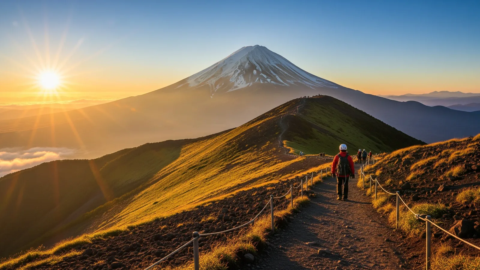
The reality of sunrise and time on the summit
Goraikō — sunrise seen from the summit — is the goal for most Fuji climbers. The reality is often very different from the postcard image.
Time of sunrise and temperature
In summer, summit sunrise is around 4:30–5:00. Before sunrise the summit sits around 5 °C, and with any wind the felt temperature drops further. A T-shirt and shorts won't tolerate even a few minutes up there — plan for winter-grade insulation.
The pre-dawn traffic jam
To stand on the summit at sunrise, you'll be climbing through the middle of the night. On weekends in peak season, the trail from the 8th station to the top can pile up into a 1–2 hour traffic jam. "I couldn't move just below the summit and watched the sunrise from the trail" is a common story, not a rare one.
Crowding and time on top
At peak season, several thousand people can be on the summit at once. Lingering chills your body and worsens any altitude symptoms, so the practical move is: see sunrise, optionally do the 'crater rim walk' (Ohachi-meguri, ~1.5 hours), then start descending.
Why the 'bullet climb' is so dangerous
A 'bullet climb' (dangan tozan) means skipping the hut, starting at night, and racing the dawn to the summit in one push. It looks economical, but the authorities involved are uniform in advising against it.
Three risks of the bullet climb
- Altitude sickness: your body gets no time to acclimatize, so risk rises sharply.
- Sleep deprivation impairing judgment: probability of trips and falls increases.
- Hypothermia: night-time cold wears you down, and there's nowhere to recover.
It's tempting to think you'll "save money" and "save time," but neither comes close to justifying the risk. Spending one night in a hut, letting your body acclimatize, and then going for sunrise is the proven best practice.
Summary
Fuji is unlike any other mountain in Japan. Get the four pillars — route choice, altitude prevention, cold-weather clothing, and a hut night — right, and the 3,776 m summit is a realistic goal. Ignore them — light clothing, a bullet climb, a pace that ignores the elevation curve — and you set yourself up for a life-threatening mistake.
Fuji is the mountain everyone dreams about, which is exactly why preparation matters so much. Check the official sources — conservation fee, route-specific official sites — to confirm current conditions, line up your gear and your schedule, and aim for the summit with margin to spare. With friends on the trail with you, both the hardship and the reward double.